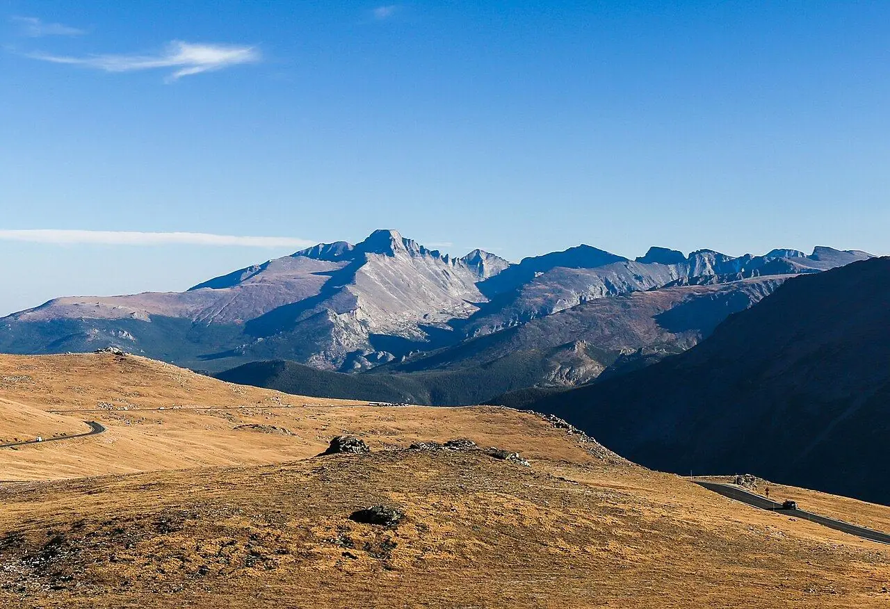
Trail Ridge Road
The highest continuous paved road in the US, with 18 kilometers above the tree line.
Photo: Rationalobserver · CC BY-SA 4.0
- Distance
- 77.0 km · 48.0 mi
- Highest point
- 3,713 m · 12,183 ft
- Difficulty
- Moderate
- Time needed
- 2 hours without stops; plan half a day
- Best season
- Late May to mid-October
Trail Ridge Road guide: Estes Park, Many Parks Curve, Forest Canyon, the Alpine Visitor Center, Milner Pass, Grand Lake, timed entry, altitude, opening dates and tips.
Trail Ridge Road at a glance
This road crosses Rocky Mountain National Park for 77 kilometers between Estes Park and Grand Lake. It climbs to 3,713 meters, the highest point of any continuous paved road in the United States, and about 18 kilometers of it run above the tree line through alpine tundra, where elk graze beside the asphalt.
The Alpine Visitor Center, at about 3,595 meters, is the highest visitor center in the national park system. West of it, the road crosses the Continental Divide at Milner Pass and drops into the Kawuneeche Valley, where moose feed in the wetlands near the source of the Colorado River.
The road usually opens around Memorial Day in late May and closes in mid-October, and snow can close it for hours even in summer. The park has used timed-entry reservations for this corridor in summer, so check before you go, and start early: afternoon storms bring lightning and fog to the high stretches.
Trail Ridge Road: stops along the way
-
1
Estes Park
The busy eastern gateway town, with lodging, restaurants and the main entrance stations.
-
2
Many Parks Curve
A curve with wide views over the meadows and valleys on the east side of the park.
-
3
Forest Canyon Overlook
A short walk on a paved path to a viewpoint high above a deep, glacier-carved canyon.
-
4
Alpine Visitor Center
The highest visitor center in the national park system, with a café and a steep trail to the top of a tundra ridge.
-
5
Milner Pass (Continental Divide)
The road crosses the Continental Divide beside Poudre Lake.
-
6
Grand Lake
A quieter western gateway on the shore of Colorado’s largest natural lake.
Trail Ridge Road: good to know
- Check whether a timed-entry reservation is needed for your date and time.
- Drink plenty of water and climb slowly; the altitude affects many visitors.
- Plan to be past the high section by early afternoon, before the storms.
- Fill up in Estes Park or Grand Lake; there is no gas along the road.
Road rules along the way
Laws change at each state line.
Colorado
- Top speed limit
- 75 mph (121 km/h)
- Phone while driving
- Hand-held phones banned
Checked Oct 25, 2026; posted signs take priority.
Fuel, rest areas and charging
Counted along 78 km (49 mi) of road.
- Gas stations
- 3
- Rest areas
- 0
- Fast chargers
- 2
- Longest stretch without gas
- 77 km · 48 mi
Where to fill up
Never more than 77 km (48 mi) between gas stations.
Leg by leg
| Leg | Distance | Gas stations | Fast chargers | Rest areas |
|---|---|---|---|---|
| Estes Park → Many Parks Curve | 19 km | 2 | 1 | 0 |
| Many Parks Curve → Forest Canyon Overlook | 12 km | 0 | 0 | 0 |
| Forest Canyon Overlook → Alpine Visitor Center | 11 km | 0 | 0 | 0 |
| Alpine Visitor Center → Milner Pass (Continental Divide) | 7 km | 0 | 0 | 0 |
| Milner Pass (Continental Divide) → Grand Lake | 30 km | 1 | 1 | 0 |
Rest areas and service plazas
There are no official rest areas on this route; plan breaks at towns, viewpoints and gas stations.
OpenStreetMap data, Oct 28, 2026.
Photo gallery
No reviews yet. Been here? Be the first to share your tips!

Traveler reviews