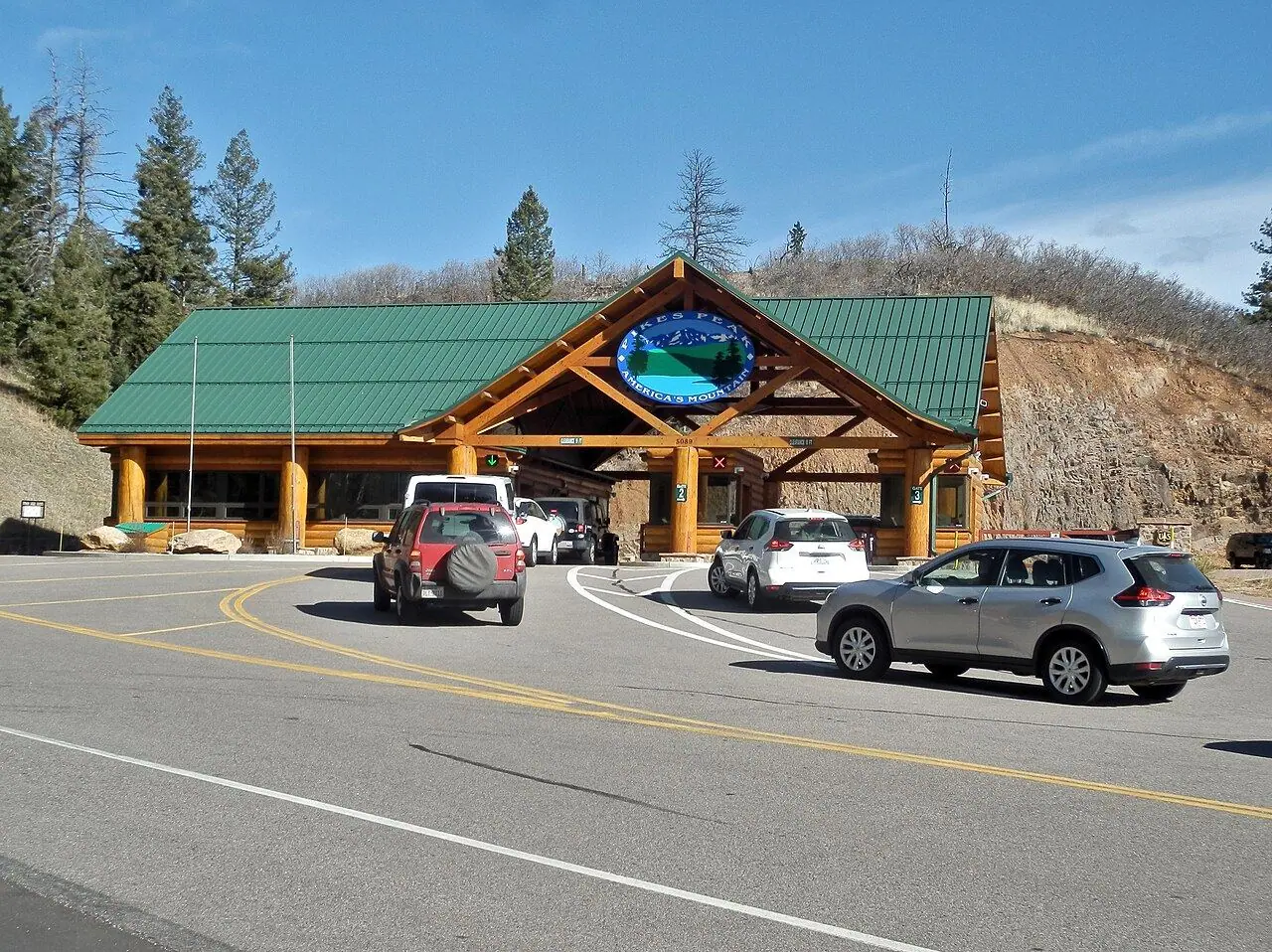
Pikes Peak Highway
A toll road with 156 curves to the summit of a 4,302-meter mountain that inspired “America the Beautiful.”
Photo: Alexander Migl · CC BY-SA 4.0
- Distance
- 31.0 km · 19.0 mi
- Highest point
- 4,302 m · 14,115 ft
- Difficulty
- Strenuous
- Time needed
- 2–3 hours up and back; plan half a day
- Best season
- All year to the point that is clear of snow; the summit is usually reached from late May to October
Pikes Peak Highway guide: the gate and toll, summit reservations and the shuttle, Crystal Creek, Glen Cove, Devils Playground, the summit visitor center, altitude, brakes and tips.
Overview
The highway climbs 31 kilometers from the gate near Cascade, west of Colorado Springs, to the summit at 4,302 meters. It is fully paved, with 156 curves and no guardrails on many stretches above the tree line, and the view from the top inspired Katharine Lee Bates to write the words of “America the Beautiful” in 1893.
The road is a toll road run by the city of Colorado Springs, and in the busy summer season drivers often need a timed reservation to park at the summit; without one, you leave the car at Devils Playground and ride a shuttle for the last stretch. The Summit Visitor Center, opened in 2021, serves the famous high-altitude donuts.
Since 1916, the road has also been the course of the Pikes Peak International Hill Climb, the second-oldest motor race in the US. At the top there is about 40 percent less oxygen than at sea level, so move slowly and descend if you feel unwell. Use a low gear on the way down; rangers check brake temperatures at Glen Cove.
Stops along the way
-
1
Pikes Peak Highway gate (Cascade)
The toll gate near the town of Cascade, where rangers check reservations and road conditions.
-
2
Crystal Creek Reservoir
A reservoir with picnic areas, a short trail and views of the north face of the peak.
-
3
Glen Cove
A lodge at the tree line, with snacks and the brake check on the way down.
-
4
Devils Playground
A wide area at mile 16, the shuttle stop for visitors without a summit reservation.
-
5
Pikes Peak summit
The summit visitor center, with donuts, exhibits and views over the plains and mountains.
Good to know
- Check whether you need a summit reservation for your date and buy it online.
- Drink water, go slowly and descend if you get a headache or feel dizzy.
- Use a low gear to descend and let the brakes cool at Glen Cove if asked.
Road rules along the way
Laws change at each state line.
Colorado
- Top speed limit
- 75 mph (121 km/h)
- Phone while driving
- Hand-held phones banned
Checked Oct 25, 2026; posted signs take priority.
Fuel, rest areas and charging
Counted along 30 km (18 mi) of road.
- Gas stations
- 0
- Rest areas
- 0
- Fast chargers
- 0
- Longest stretch without gas
- 30 km · 18 mi
Where to fill up
Never more than 30 km (18 mi) between gas stations.
Leg by leg
| Leg | Distance | Gas stations | Fast chargers | Rest areas |
|---|---|---|---|---|
| Pikes Peak Highway gate (Cascade) → Crystal Creek Reservoir | 6 km | 0 | 0 | 0 |
| Crystal Creek Reservoir → Glen Cove | 13 km | 0 | 0 | 0 |
| Glen Cove → Devils Playground | 5 km | 0 | 0 | 0 |
| Devils Playground → Pikes Peak summit | 5 km | 0 | 0 | 0 |
Rest areas and service plazas
There are no official rest areas on this route; plan breaks at towns, viewpoints and gas stations.
OpenStreetMap data, Oct 28, 2026.
Photo gallery
No reviews yet. Been here? Be the first to share your tips!

Traveler reviews