Route 66 in Arizona: Seligman to Topock
The longest unbroken stretch of the Mother Road, from neon diners in Seligman to the wild burros of Oatman.
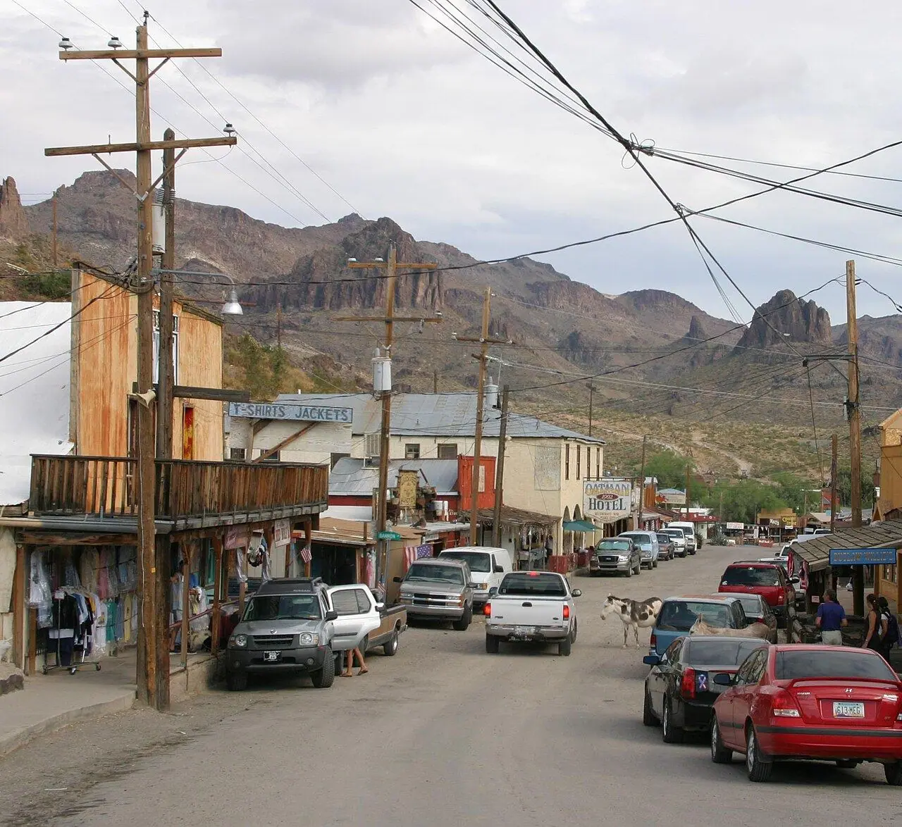
Photo: Pretzelpaws [1] · CC BY-SA 3.0
- Distance
- 255 km · 158 mi
- Highest point
- 1,600 m · 5,250 ft
- Difficulty
- Moderate
- Time needed
- One long day; two days with stops
- Best season
- October–April; summer is very hot near the Colorado River
Route 66 in Arizona guide: Seligman, Grand Canyon Caverns, Peach Springs, Hackberry, Kingman, the hairpins of Sitgreaves Pass, Oatman’s burros, fuel, vehicle limits and tips.
Overview
Between Seligman and Topock on the Colorado River, about 255 kilometers of the old highway survive without a break, the longest continuous stretch of Route 66 left anywhere. When Interstate 40 bypassed the towns in the 1970s and 1980s, many of them nearly vanished, until a barber in Seligman, Angel Delgadillo, helped found the Historic Route 66 Association of Arizona in 1987 and started the revival of the whole road.
From Seligman, with its kitschy diners and souvenir shops, the road curves across open ranch land past Grand Canyon Caverns, through Peach Springs on the Hualapai reservation and on to the Hackberry General Store, a roadside museum of rusting cars and old gas pumps. Kingman has the Arizona Route 66 Museum inside its historic Powerhouse visitor center.
West of Kingman, the road climbs the Black Mountains in tight hairpins without guardrails to Sitgreaves Pass, then drops to Oatman, an old gold-mining town where wild burros, descendants of the miners’ animals, wander the main street. Long RVs and trailers should take I-40 for this section instead.
Route 66: stops along the way
-
1
Seligman
The town that started the revival of the road, with neon signs, diners and the barbershop of Angel Delgadillo.
-
2
Grand Canyon Caverns
A dry limestone cave 64 meters underground, reached by an elevator, with a motel and diner on the road.
-
3
Peach Springs
The capital of the Hualapai Tribe, the starting point for trips to Grand Canyon West.
-
4
Hackberry General Store
A restored store and gas station packed with old signs, vintage cars and Route 66 souvenirs.
-
5
Kingman
The hub of the route in Arizona, with a Route 66 museum, motels and a full range of services.
-
6
Sitgreaves Pass
A narrow pass in the Black Mountains with steep curves and wide views over three states.
-
7
Oatman
A mining town with wooden sidewalks, staged gunfights on weekends and wild burros in the street.
-
8
Topock
The road ends at the Colorado River, across from California.
Good to know
- Fill up in Seligman and Kingman; services are far apart.
- Drive the Oatman section only with vehicles shorter than about 12 meters (40 feet).
- Do not feed the burros anything other than the hay cubes sold in Oatman shops.
Road rules along the way
Laws change at each state line.
Arizona
- Top speed limit
- 75 mph (121 km/h)
- Phone while driving
- Hand-held phones banned
Checked Oct 25, 2026; posted signs take priority.
Fuel, rest areas and charging
Counted along 231 km (143 mi) of road.
- Gas stations
- 36
- Rest areas
- 0
- Fast chargers
- 2
- Longest stretch without gas
- 70 km · 44 mi
Where to fill up
Never more than 70 km (44 mi) between gas stations.
Leg by leg
| Leg | Distance | Gas stations | Fast chargers | Rest areas |
|---|---|---|---|---|
| Seligman → Grand Canyon Caverns | 41 km | 3 | 0 | 0 |
| Grand Canyon Caverns → Peach Springs | 21 km | 0 | 0 | 0 |
| Peach Springs → Hackberry General Store | 39 km | 4 | 0 | 0 |
| Hackberry General Store → Kingman | 45 km | 14 | 0 | 0 |
| Kingman → Sitgreaves Pass | 36 km | 14 | 2 | 0 |
| Sitgreaves Pass → Oatman | 10 km | 0 | 0 | 0 |
| Oatman → Topock | 40 km | 1 | 0 | 0 |
Rest areas and service plazas
There are no official rest areas on this route; plan breaks at towns, viewpoints and gas stations.
OpenStreetMap data, Oct 28, 2026.
Photo gallery
No reviews yet. Been here? Be the first to share your tips!

Traveler reviews