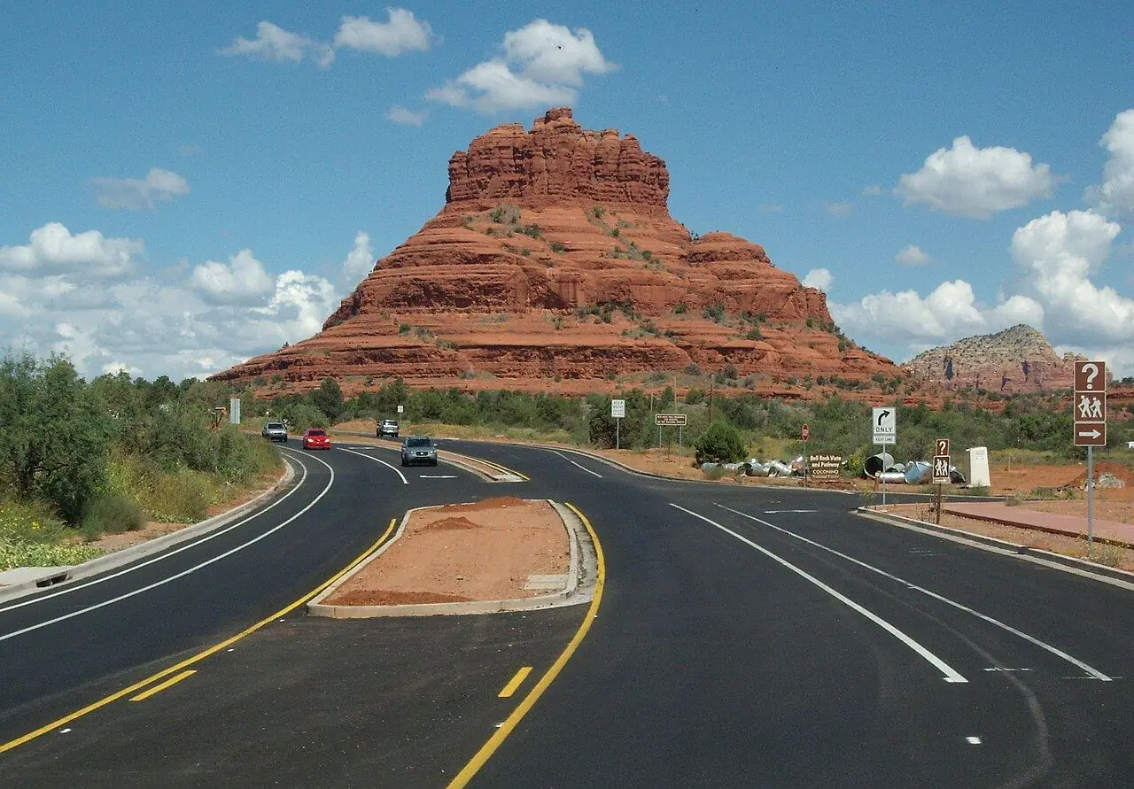
Red Rock Scenic Byway
A short road into Sedona past Bell Rock, Courthouse Butte and a chapel built into the red cliffs.
Photo: Josep Renalias · CC BY-SA 3.0
- Distance
- 12.0 km · 7.5 mi
- Highest point
- 1,340 m · 4,400 ft
- Difficulty
- Easy
- Time needed
- 20 minutes without stops; plan half a day
- Best season
- All year; March–May and October–November are the most pleasant
Red Rock Scenic Byway guide in Sedona: the visitor center, Bell Rock, Courthouse Butte, the Chapel of the Holy Cross, Tlaquepaque, the Red Rock Pass, trail parking and tips.
Overview
State Route 179 runs 12 kilometers from the Village of Oak Creek to Sedona and is one of Arizona’s All-American Roads. In that short distance it passes some of the most famous rock formations in the Southwest, red sandstone buttes and spires shaped by wind and water, glowing deep orange in the late afternoon light.
Bell Rock and Courthouse Butte rise right beside the road, with easy trails around their base. Farther north, the Chapel of the Holy Cross, completed in 1956, is built into the rock between two red pinnacles, with a giant cross in its glass wall. The byway ends at Tlaquepaque, an arts village of shops and courtyards, near the center of town.
Parking at many trailheads along the road requires a national forest parking pass, which is sold at machines and visitor centers; America the Beautiful passes are accepted. The road is busy on weekends and holidays, so start early, and stay for the clear night skies, protected by Sedona’s dark-sky rules.
Stops along the way
-
1
Red Rock Visitor Center
A national forest visitor center with maps, trail advice and parking pass sales.
-
2
Bell Rock
A bell-shaped butte beside the road, with short trails around its base.
-
3
Chapel of the Holy Cross
A chapel built into the red rock in 1956, with a view over the valley.
-
4
Tlaquepaque and Uptown Sedona
An arts village with galleries and courtyards at the end of the byway.
Good to know
- Buy the local parking pass, or show an America the Beautiful pass, before parking at trailheads.
- Arrive before 8 a.m. for parking at Bell Rock and Cathedral Rock.
- Take the free Sedona shuttle to the busiest trailheads.
Road rules along the way
Laws change at each state line.
Arizona
- Top speed limit
- 75 mph (121 km/h)
- Phone while driving
- Hand-held phones banned
Checked Oct 25, 2026; posted signs take priority.
Fuel, rest areas and charging
Counted along 16 km (10 mi) of road.
- Gas stations
- 3
- Rest areas
- 0
- Fast chargers
- 0
- Longest stretch without gas
- 13 km · 8 mi
Where to fill up
Never more than 13 km (8 mi) between gas stations.
Leg by leg
| Leg | Distance | Gas stations | Fast chargers | Rest areas |
|---|---|---|---|---|
| Red Rock Visitor Center → Bell Rock | 4 km | 2 | 0 | 0 |
| Bell Rock → Chapel of the Holy Cross | 6 km | 0 | 0 | 0 |
| Chapel of the Holy Cross → Tlaquepaque and Uptown Sedona | 6 km | 0 | 0 | 0 |
Rest areas and service plazas
There are no official rest areas on this route; plan breaks at towns, viewpoints and gas stations.
OpenStreetMap data, Oct 28, 2026.
No reviews yet. Been here? Be the first to share your tips!

Traveler reviews