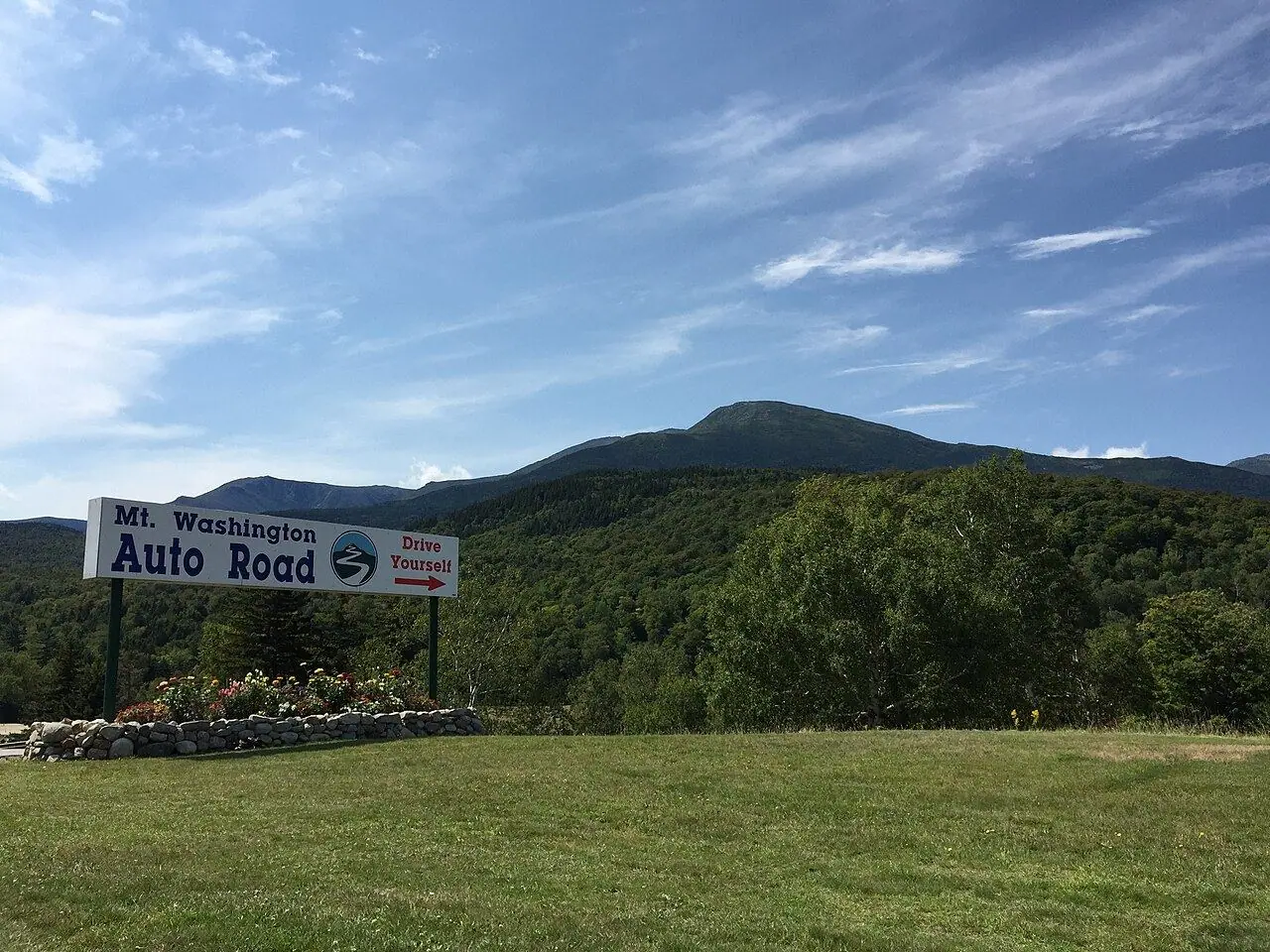
Mount Washington Auto Road
America’s oldest man-made tourist attraction climbs to the highest summit in the Northeast, home of some of the worst weather on Earth.
Photo: Famartin · CC BY-SA 4.0
- Distance
- 12.2 km · 7.6 mi
- Highest point
- 1,917 m · 6,288 ft
- Difficulty
- Strenuous
- Time needed
- 30 minutes up; plan 2–3 hours in total
- Best season
- Mid-May to late October, weather permitting
Mount Washington Auto Road guide: the toll and vehicle rules, guided tours, the Halfway House, the Cow Pasture, the summit and its weather station, the famous bumper sticker and tips.
Overview
Opened in 1861, the Auto Road climbs 12.2 kilometers from the Glen House in Pinkham Notch to the summit of Mount Washington at 1,917 meters, the highest peak in the northeastern United States. The average grade is 12 percent, with narrow stretches, sharp drop-offs and no guardrails, and the upper part is unpaved gravel in places.
The summit is famous for its weather: in 1934 the observatory measured a wind gust of 372 km/h, for decades the highest ever recorded. Fog, wind and cold can arrive at any time of year, so the road can close even in summer, and the temperature at the top is often 15–20 degrees colder than at the base.
A toll is charged per vehicle and driver, and some vehicles, such as large RVs and trailers, are not allowed; guided tours in vans leave from the base for anyone who prefers not to drive. Drivers receive the classic “This Car Climbed Mt. Washington” bumper sticker. At the top, the Sherman Adams Visitor Center and the Mount Washington Observatory’s museum explain the extreme climate.
Mount Washington: stops along the way
-
1
Glen House (base)
The base lodge in Pinkham Notch, where you pay the toll and can book a guided tour.
-
2
Halfway House
A historic stop at about mile 4, once used to change horses on the way up.
-
3
Cow Pasture
An open alpine area above the tree line with wide views over the Presidential Range.
-
4
Mount Washington summit
The summit, with a visitor center, a weather museum and the cog railway arriving from the west.
Good to know
- Check the summit forecast and the road status before you go.
- Use a low gear on the way down and stop to let the brakes cool.
- Bring warm clothes and a windproof jacket, even on a hot day in the valley.
Road rules along the way
Laws change at each state line.
New Hampshire
- Top speed limit
- 70 mph (113 km/h)
- Phone while driving
- Hand-held phones banned
Checked Oct 25, 2026; posted signs take priority.
Fuel, rest areas and charging
Counted along 13 km (8 mi) of road.
- Gas stations
- 1
- Rest areas
- 1
- Fast chargers
- 0
- Longest stretch without gas
- 12 km · 7 mi
Where to fill up
Never more than 12 km (7 mi) between gas stations.
Leg by leg
| Leg | Distance | Gas stations | Fast chargers | Rest areas |
|---|---|---|---|---|
| Glen House (base) → Halfway House | 5 km | 1 | 0 | 0 |
| Halfway House → Cow Pasture | 6 km | 0 | 0 | 1 |
| Cow Pasture → Mount Washington summit | 2 km | 0 | 0 | 0 |
Rest areas and service plazas
- 9 km Rest area Rest area
OpenStreetMap data, Oct 28, 2026.
Photo gallery
No reviews yet. Been here? Be the first to share your tips!

Traveler reviews