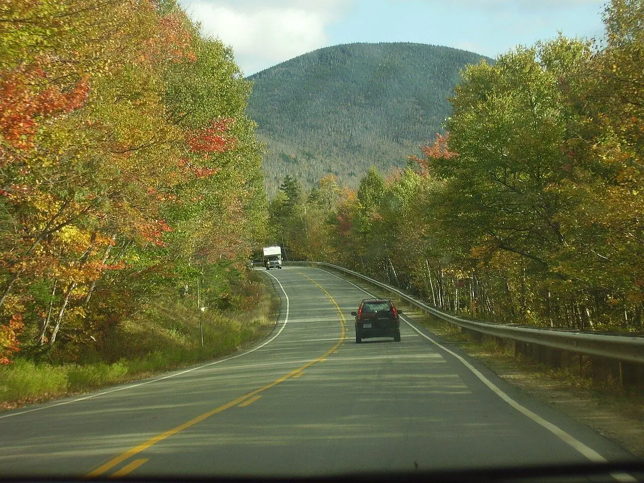
Kancamagus Highway
Fifty-six kilometers of New Hampshire forest, rivers and waterfalls, with no towns, gas or billboards along the way.
Photo: Polaron at en.wikipedia · CC BY-SA 3.0
- Distance
- 56.0 km · 34.5 mi
- Highest point
- 870 m · 2,855 ft
- Difficulty
- Easy
- Time needed
- 1 hour without stops; plan half a day
- Best season
- All year; best from late September to mid-October
Kancamagus Highway guide: Lincoln, the Kancamagus Pass, Sabbaday Falls, Rocky Gorge, Lower Falls, the Albany Covered Bridge, Conway, parking passes, fall foliage and tips.
Kancamagus Highway at a glance
New Hampshire Route 112 crosses the White Mountain National Forest between Lincoln and Conway, a drive of 56 kilometers known to locals as “the Kanc.” It is named after Kancamagus, a 17th-century sachem of the Pennacook people, and it climbs to the Kancamagus Pass at 870 meters before following the Swift River down to the east.
There are no gas stations, shops or billboards on the road, only overlooks, campgrounds and trailheads. Sabbaday Falls, a short walk from the road, pours through a narrow gorge, while Rocky Gorge and Lower Falls are popular places to sit on the granite ledges by the river; near the eastern end, the Albany Covered Bridge dates from 1858.
In early October the forest turns red, orange and gold, and the road is one of the most famous fall foliage drives in New England, with heavy traffic on weekends. Moose sometimes feed near the road at dawn and dusk. A day pass from the national forest is needed to park at many of the stops.
Kancamagus Highway: stops along the way
-
1
Lincoln
The western start, with gas, restaurants and Loon Mountain resort.
-
2
Kancamagus Pass
The highest point of the road, with overlooks over the Pemigewasset Wilderness.
-
3
Sabbaday Falls
A short trail to a waterfall pouring through a narrow granite gorge.
-
4
Rocky Gorge
The Swift River squeezing through a small gorge, with a footbridge and an easy loop.
-
5
Lower Falls
Wide granite ledges and pools by the river, popular for picnics in summer.
-
6
Albany Covered Bridge
A red wooden covered bridge from 1858 over the Swift River, next to a campground.
-
7
Conway
The eastern end, a busy town with outlet shops and the gateway to the Mount Washington Valley.
Kancamagus Highway: good to know
- Fill up in Lincoln or Conway; there is no gas on the highway.
- Buy a national forest day pass for parking, at the trailheads or in advance.
- Drive it on a weekday in early October for the colors without the worst traffic.
Road rules along the way
Laws change at each state line.
New Hampshire
- Top speed limit
- 70 mph (113 km/h)
- Phone while driving
- Hand-held phones banned
Checked Oct 25, 2026; posted signs take priority.
Fuel, rest areas and charging
Counted along 57 km (36 mi) of road.
- Gas stations
- 3
- Rest areas
- 0
- Fast chargers
- 1
- Longest stretch without gas
- 57 km · 35 mi
Where to fill up
Never more than 57 km (35 mi) between gas stations.
Leg by leg
| Leg | Distance | Gas stations | Fast chargers | Rest areas |
|---|---|---|---|---|
| Lincoln → Kancamagus Pass | 20 km | 2 | 1 | 0 |
| Kancamagus Pass → Sabbaday Falls | 11 km | 0 | 0 | 0 |
| Sabbaday Falls → Rocky Gorge | 11 km | 0 | 0 | 0 |
| Rocky Gorge → Lower Falls | 5 km | 0 | 0 | 0 |
| Lower Falls → Albany Covered Bridge | 0 km | 0 | 0 | 0 |
| Albany Covered Bridge → Conway | 11 km | 1 | 0 | 0 |
Rest areas and service plazas
There are no official rest areas on this route; plan breaks at towns, viewpoints and gas stations.
OpenStreetMap data, Oct 28, 2026.
Kancamagus Highway in photos
No reviews yet. Been here? Be the first to share your tips!

Traveler reviews