I-80 Nevada
I-80 Exit 13: Reno, Nevada
Take it for US 395 Business, US 395 BUS and Downtown Reno. I-80 exit 13 lies right at Reno (Nevada). Close to the ramps there are 2 gas stations, 15 places to eat, 15 hotels and 6 EV chargers. Counting from the west end of I-80 in Nevada, it is the 11th numbered interchange, 13 miles from the California line.
About 283,600 people live in Reno. Fernley lies 33 miles eastbound, around 30 minutes of driving from I-80 exit 13. Sacramento lies 127 miles westbound, around 2.0 hours of driving from I-80 exit 13.
- 2 gas
- 15 food
- 15 hotels
- 6 EV
- Next gas: Eastbound 1 mile · Westbound 1 mile
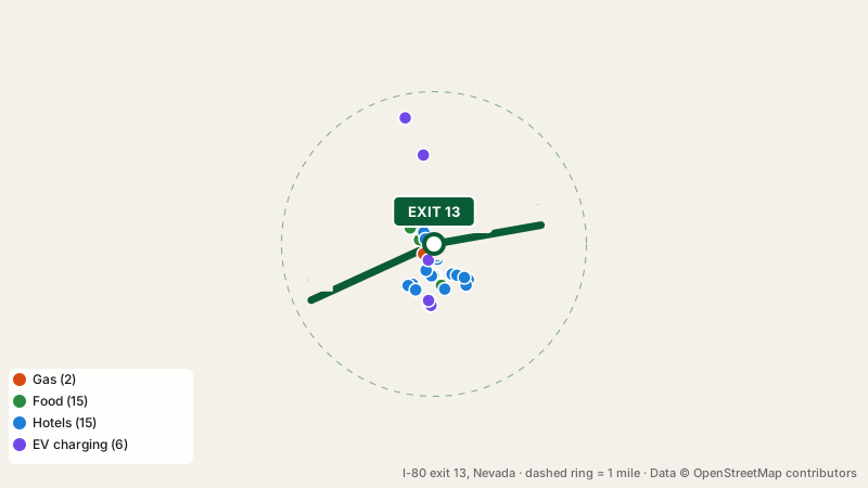
Fuel near I-80 exit 13
Nearest to the off-ramp: Chevron (0.1 miles). 2 stations compete here: Chevron and Jacksons. The following fuel stop eastbound is exit 14, 1 mile away; westbound the next gas is at exit 12, 1 mile away.
Meals close to I-80 exit 13
Capriotti's Sandwich Shop, Robertos, The Mill Juice Shop, Madame Butterwork’s Curious Café and 11 more top the list of 6 fast food spots, 3 cafes and 6 restaurants. Menus include sandwich, mexican, chinese and burger.
Where to stay near I-80 exit 13
Need a bed? Travelodge is 0.1 miles from the ramp, and 14 more places to stay are nearby.
Plugging in at I-80 exit 13
6 charging stations are mapped here: ChargePoint, Tesla Destination Charger, EV charging station and 1 more. DC fast charging is available at Tesla Supercharger. Fast chargers on either side: exit 19, 6 miles eastbound; otherwise exit 10, 3 miles westbound.
Rest areas before and after I-80 exit 13
I-80 exit 13 itself has no restrooms beyond its businesses. Eastbound drivers reach Trinity Rest Area, 70 miles ahead. Next rest area westbound: Rest area near mile 6, 7 miles ahead.
What the next exits offer
Quick answers about I-80 exit 13
Is there gas at I-80 exit 13?
Yes: Chevron and Jacksons are within a mile of I-80 exit 13.
Which town is at I-80 exit 13?
Reno, Nevada is right at I-80 exit 13.
Which hotels are closest to I-80 exit 13?
Yes, 15 hotels near I-80 exit 13: Travelodge, Howard Johnson, Motel Capri and 12 more.
Where can I use a restroom after I-80 exit 13?
Rest area near mile 6, 7 miles westbound of this exit.
Plan a trip from this exit All I-80 exits in Nevada
Source: OpenStreetMap, · Report a problem