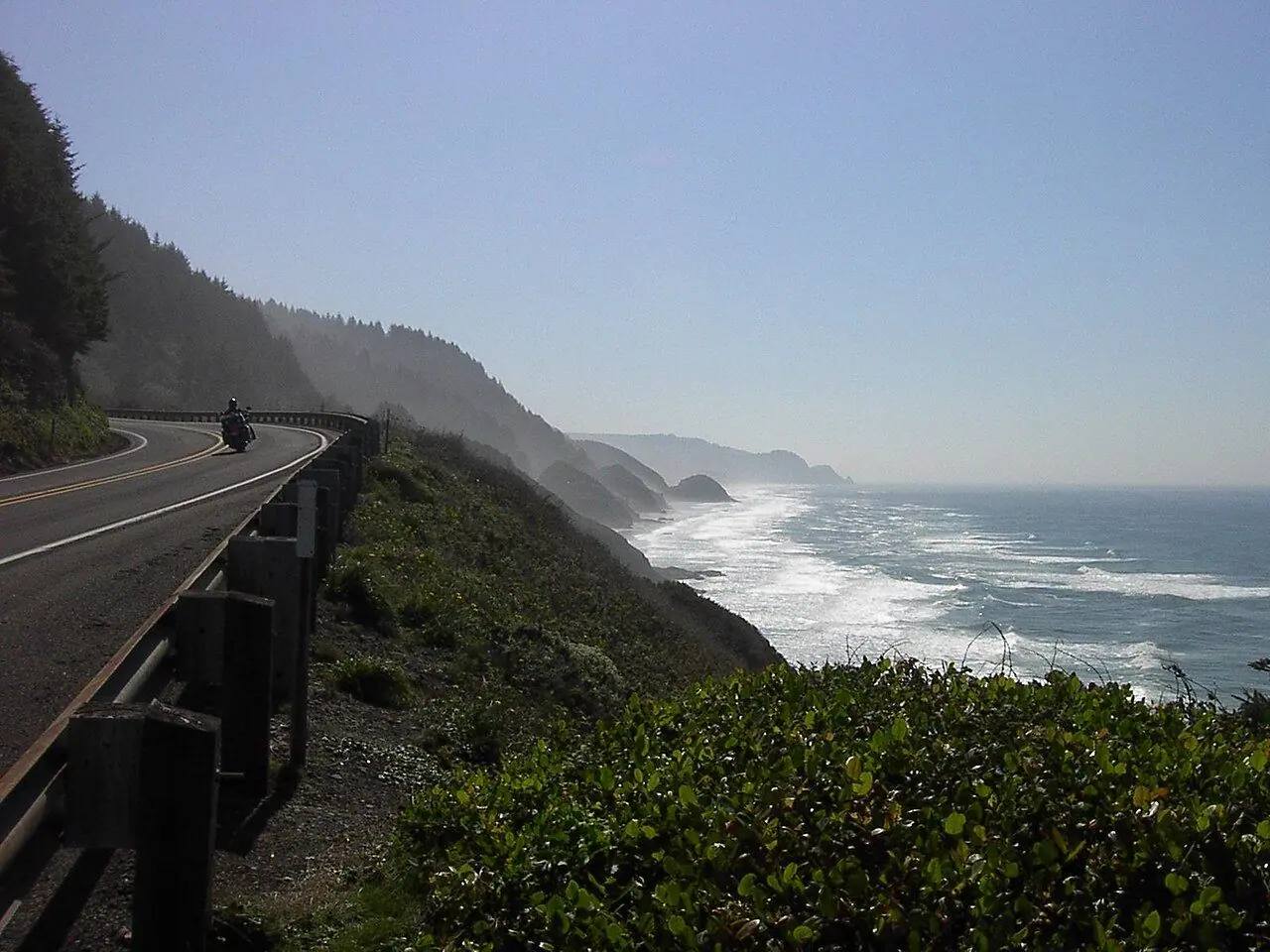
Oregon Coast by RV (US-101)
Haystack Rock, lighthouses and a coastline where every beach belongs to the public.
Photo: JT Perreault · Public domain
- Distance
- 584 km · 363 mi
- Difficulty
- Easy
- Time needed
- 4–6 days
- Suggested days
- 5 days
- Best season
- June–September; September is often the clearest month
Oregon Coast RV route guide: Astoria, Cannon Beach and Haystack Rock, Tillamook, Newport, Thor’s Well, the Oregon Dunes, Bandon, campgrounds and the best season.
Oregon Coast at a glance
US-101 follows almost the entire Oregon Coast, 584 kilometers from the Columbia River at Astoria to the California border near Brookings. Thanks to the 1967 Beach Bill, every beach in Oregon is open to the public, and the road links dozens of state parks, lighthouses and small towns.
Highlights come one after another: Haystack Rock at Cannon Beach, the creamery in Tillamook, the aquarium in Newport, the churning hole of Thor’s Well at Cape Perpetua, the Oregon Dunes near Florence and the sea stacks of Bandon. Heceta Head Lighthouse, perched on a headland, is one of the most photographed lighthouses in the country.
State parks along the coast have many RV campgrounds with hookups, plus yurts and cabins for a night out of the rig; summer weekends book up months ahead. The road is easy to drive but slow, with frequent curves and towns, so plan four to six days.
Oregon Coast: stops along the way
-
1
Astoria
An old port at the mouth of the Columbia, with the Astoria Column and the house from The Goonies.
-
2
Cannon Beach
Haystack Rock and its tide pools, with puffins in spring and early summer.
-
3
Tillamook
Dairy country and the Tillamook Creamery visitor center.
-
4
Newport
The Oregon Coast Aquarium, Yaquina Head lighthouse and a working bayfront.
-
5
Florence
The northern gateway to the Oregon Dunes and Heceta Head Lighthouse.
-
6
Bandon
Sea stacks on Face Rock beach and an old town by the harbor.
-
7
Brookings
Mild weather, the Samuel H. Boardman State Scenic Corridor and the California border.
Oregon Coast: good to know
- Book state park campgrounds on the coast early for summer weekends.
- Check tide tables before visiting Thor’s Well and the tide pools, and never turn your back on the ocean: sneaker waves are real.
- Expect morning fog in summer; September is often the sunniest month.
Road rules along the way
Laws change at each state line.
Oregon
- Top speed limit
- 70 mph (113 km/h)
- Phone while driving
- Hand-held phones banned
Checked Oct 25, 2026; posted signs take priority.
Fuel, rest areas and charging
Counted along 546 km (339 mi) of road.
- Gas stations
- 73
- Rest areas
- 4
- Fast chargers
- 15
- Longest stretch without gas
- 51 km · 32 mi
Where to fill up
Never more than 51 km (32 mi) between gas stations.
Leg by leg
| Leg | Distance | Gas stations | Fast chargers | Rest areas |
|---|---|---|---|---|
| Astoria → Cannon Beach | 41 km | 14 | 4 | 1 |
| Cannon Beach → Tillamook | 65 km | 7 | 2 | 0 |
| Tillamook → Newport | 110 km | 16 | 3 | 1 |
| Newport → Florence | 79 km | 9 | 2 | 0 |
| Florence → Bandon | 117 km | 17 | 3 | 0 |
| Bandon → Brookings | 134 km | 10 | 1 | 2 |
Rest areas and service plazas
- 38 km Rest area Rest area
- 114 km Tillamook River Rest Area Rest area
- 485 km Ophir Rest Area Rest area
- 544 km Rest area Rest area
OpenStreetMap data, Oct 28, 2026.
Photo gallery
No reviews yet. Been here? Be the first to share your tips!

Traveler reviews